Thanks to a recent grant from the National Endowment for the Humanities under the Preservation and Access Division’s Research and Development program, the USC Digital Library and the Spatial Sciences Institute (SSI) at USC Dornsife College are working together to unlock important information from historic maps.
The project team, led by Deborah Holmes-Wong of the USC Digital Library and Yao-Yi Chiang of SSI, is trying to solve a problem faced by libraries and archives around the world. There are vast quantities of maps in most university libraries, and USC is no exception. These hold a wealth of information about changing borders, cultures, and demographics over hundreds of years. Yet many of these historical maps have not yet been digitized or even cataloged, so they are exceedingly difficult to access.
Building on Chiang’s pioneering research into techniques for capturing text from historic maps and his open-source Strabo software, the team hopes to significantly reduce the time needed to catalog maps and publish them in online resources such as the USC Digital Library, the first California content hub for the Digital Public Library of America (DPLA).
The preliminary results from the NEH-supported project are promising, as shown above in a 1961 U.S. Geological Survey (USGS) map showing Brawley and El Centro, California, close to the U.S.-Mexico border. Using Strabo, Chiang and computer science and spatial informatics graduate students Ishan Alok, Yi Chen, and Zhiyun Wang captured important information like survey dates as well as labels for cities, irrigation canals, and other geographical features on the USGS map.
The team believes some of this information can be used to partially automate the process of cataloging maps, which is a time-consuming, essential part of creating digital map collections. Cataloging enables individual maps from specific regions and dates to be found when people search for them in vast online resources like the USC Digital Library and Digital Public Library of America.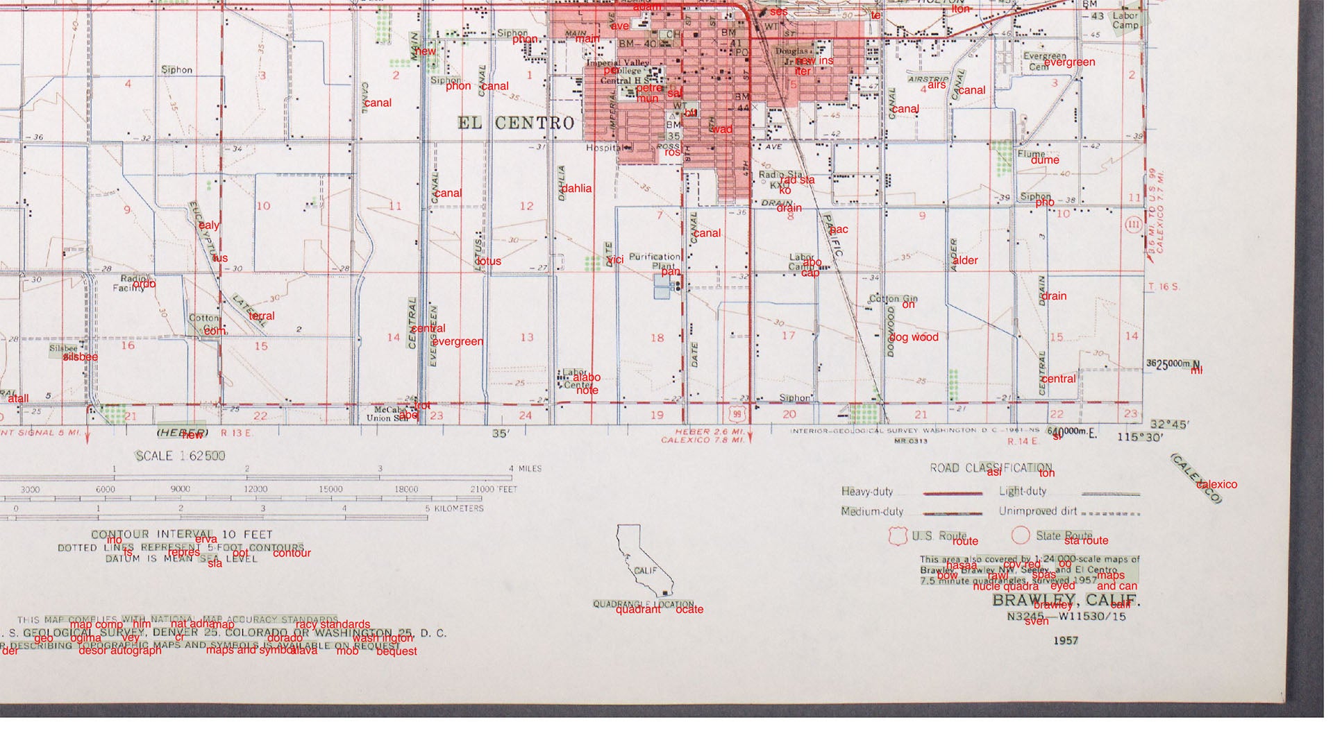 As part of the NEH-supported project, the team will measure Strabo’s results using a selection of 25 maps. In future projects, the team will experiment with automating the map cataloging process with Strabo and cloud-based computing resources. They hope to enable digital libraries everywhere to employ similar techniques, speeding their efforts to make their vast map archives freely available online.
Project team members include Holmes-Wong, Zahid Rafique and Wayne Shoaf from the USC Digital Library and Chiang, Alok, Chen, and Wang from SSI. As the team continues their work with USGS and British government Ordnance Survey maps, we will share more results from this innovative project.